Aims

With the aim of studying land-use-change patterns of plant covers, information is being compiled on the past vegetation of Sierra Nevada through old aerial photographs (1956). This enables identify singular areas with ecological processes of special interest in the global-change study.

Method and effort

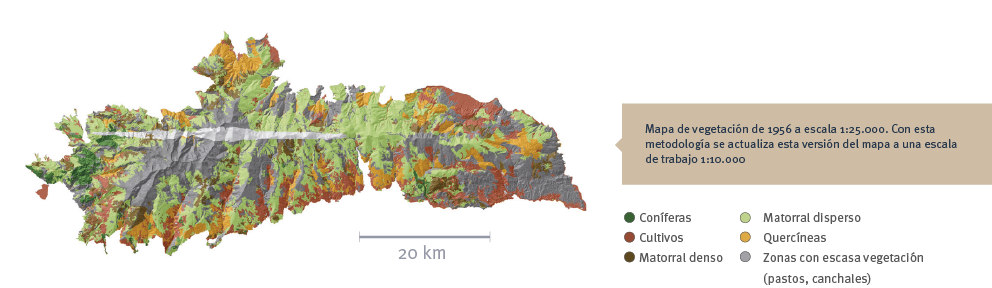
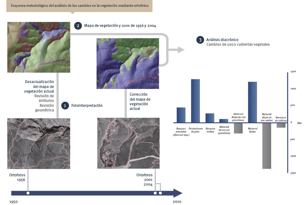
This consists of reinterpreting the most current version of the vegetation map at 1:10,000 over the orthophotography of 1956, reviewing geometry and attributes. With the use of the appropriate GIS edition tools, more than 35,000 polygons are reviewed. All the information generated is combined into a normalized geographic database to be made compatible with other data models (SIOSE and REDIAM). This map makes it possible: to perform diachronic analyses of the plant cover and land uses, as well as to detect ecological processes such as elevational migrations, colonization of degraded habitats, etc.

Periodicity

At present, there are photos of Sierra Nevada of sufficient quality for the dates: 1956, 1977, 1984, 1998, 2001, 2004, 2007, and 2009.

References

Consejería de Medio Ambiente 2007. Guía técnica del Mapa de Usos y Coberturas Vegetales del Suelo de Andalucía 1:25.000. Red de Información Ambiental, Junta de Andalucía. 250 pp.
Molero Mesa, J., Pérez Raya, F., López Nieto, J.M., El Aallali, A. y Hita Fernández, J.A. 2001. Cartografía y evaluación de la vegetación del Parque Natural de Sierra Nevada. Consejería de Medio Ambiente. 230 pp.
Navarro González, I. y Bonet García, F.J. 2009. Caracterización de la evolución histórica de la cubierta vegetal y los usos del suelo de Sierra Nevada en un contexto de cambio global. En: IX Congreso Nacional de la Asociación Española de Ecología Terrestre: La dimensión ecológica del desarrollo sostenible: Ecología, del conocimiento a la aplicación. Úbeda, 18-22 Octubre 2009.

en_USEN