The EMI Concept
We define an EMI as an ecologically homogeneous plot of land centered around a multi-parameter station with a high concentration of sensors and data collection protocols for atmospheric, soil, and biological data. In an EMI, in addition to the data from the multi-parameter station itself (relative humidity, precipitation, solar radiation, air and soil temperature, wind speed and direction, atmospheric pressure, UVB1 and UVA1 radiation, and snow level), biological data (flora and fauna) are collected through the Sierra Nevada Global Change Observatory monitoring protocols, along with remote sensing data (snow cover, albedo, vegetation indices, productivity, fires). Therefore, an EMI can be considered a "hotspot" for high-frequency, high-quality data. Within an EMI area, every piece of data collected has a precise geographic location defined in a Geographic Information System (GIS).
To define the extent of the different EMIs, several key aspects must be considered:
- They must be areas surrounding the multi-parameter stations established in Sierra Nevada within the project: Establishment of a global change monitoring network in National Parks
- They must contain a high concentration of monitoring protocols. In this sense, each EMI is a hotspot for obtaining both ecological data (from the Sierra Nevada Global Change Observatory) and data from sensors and the meteorological station itself.
- They must be ecologically homogeneous areas, ensuring that each EMI largely represents one of the primary ecosystems of Sierra Nevada.
To identify the areas with the highest concentration of sampling protocols, a review of all socio-ecological monitoring protocols currently active within the Sierra Nevada Global Change Observatory was conducted, considering their spatial location and topology (point, line, polygon). By spatializing these protocols, we generated a map of sampling protocol concentration or density across the territory.
To obtain this concentration map, we used Kernel Density Estimation (KDE), one of the most widely used techniques for hotspot analysis and detection. This technique aims to produce a smoothed density surface of point events across space by computing intensity and density to estimate event distribution. Applying this methodology resulted in a standardized density map of monitoring protocols, from which the Intensive Monitoring Stations (EMIs) were delimited.
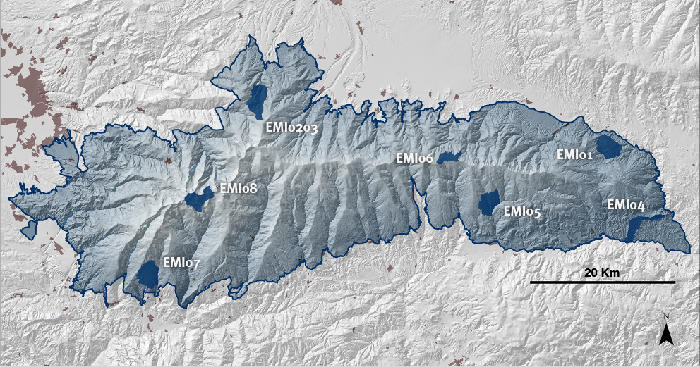
Location of the Intensive Monitoring Stations
Patrocinadores
The Fundación Biodiversidad financia el Observatorio a través del proyecto denominado: Seguimiento de los efectos del cambio global en Sierra Nevada. Diseño y desarrollo de un sistema de monitorización ecológica.