Sierra Nevada Global Change Observatory

Cadastral map of Cáñar (1920)

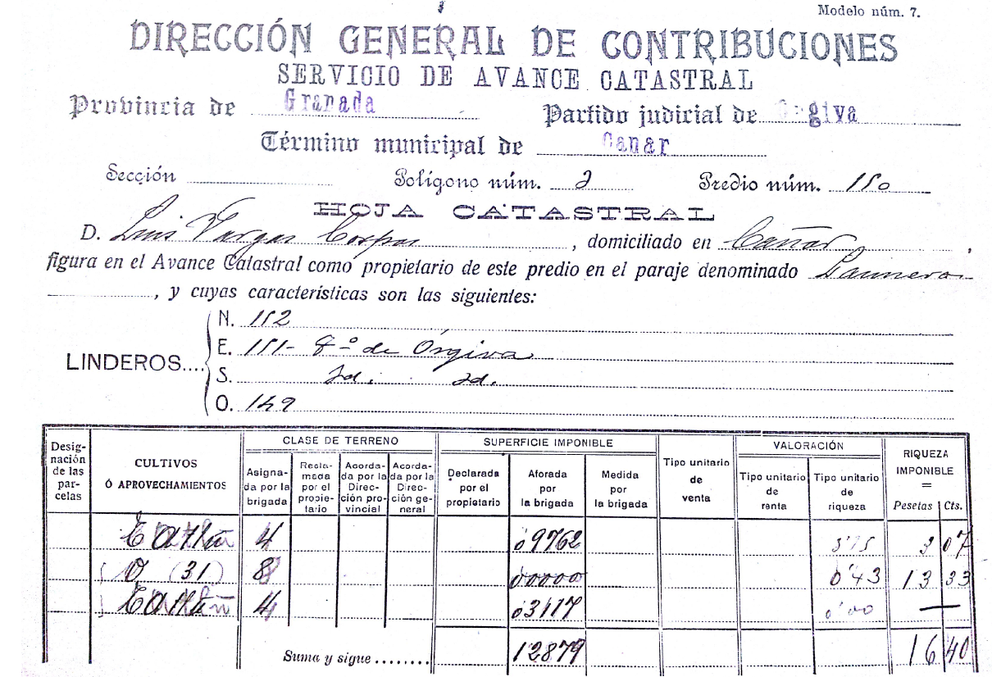
By Royal Decree of October 9, 1902, the Cadastre Board (Junta de Catastro) was created, better known as the Echegaray Board. This Board drafted the Law of March 23, 1906, which stipulated that the Cadastre would be carried out in two phases: an initial Cadastral Advance (Avance Catastral), followed by a second phase for the preparation of the Parcel Cadastre (Catastro Parcelario).

The Cadastral Advance consisted of two stages:

  • Planimetric: This involved the creation of a map (freehand sketch) for each municipal district at a scale of 1:25,000, identifying cadastral polygons and plots within its perimeter.
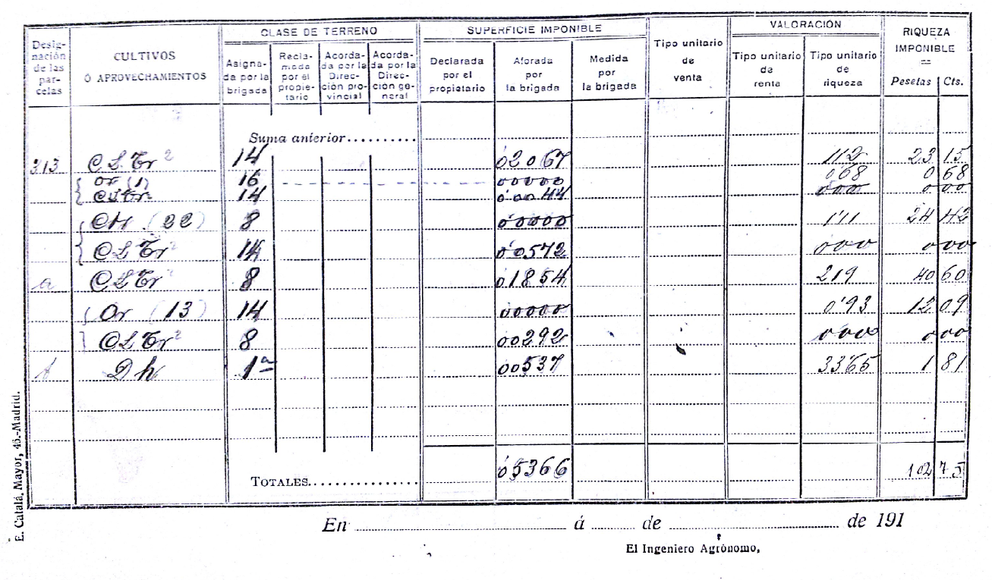
  • Agronomic: This included a literal description of the plots, identification of crop masses, and determination of the taxable net products for different types of land.

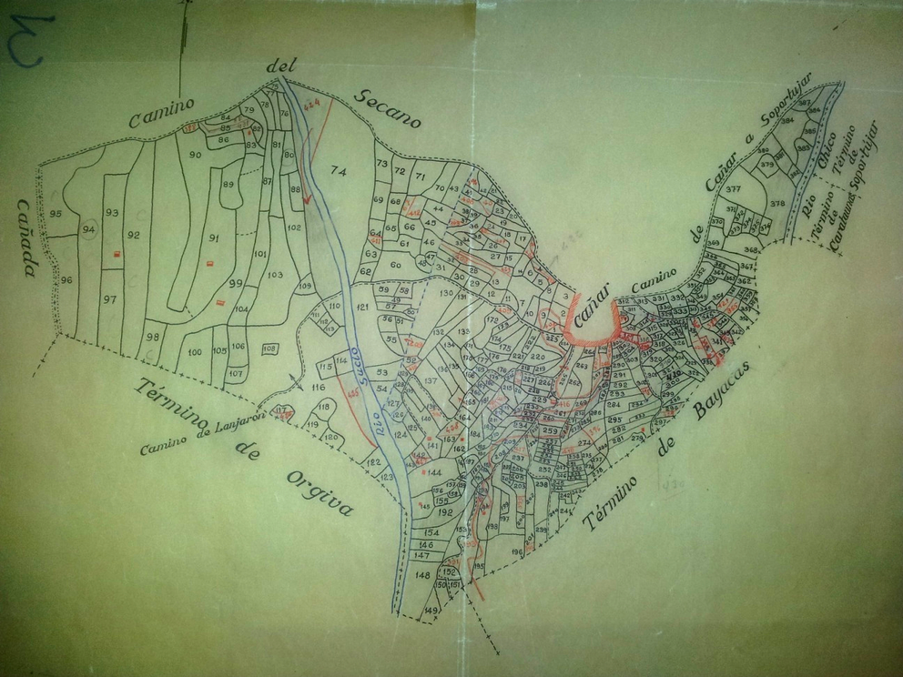
The graphic component corresponds to a non-topographic survey in which the technician created a sketch of each cadastral polygon and, within them, drew and numbered the cadastral plots. The following image shows Polygon No. 3 of Cáñar (Granada).

Polygon No. 3 with its constituent plots. Municipal district of Cáñar, Granada

Methodology

For the municipality of Cáñar, data was collected from nearly 1,000 Cadastral Sheets corresponding to three polygons, totaling 967 plots. This information was entered into a database recording all land uses present in each plot, the surface area occupied, and the percentage of the plot's total area represented by each use. Additionally, the trees present in each plot were counted.

Example of a Cadastral Advance Sheet. Obverse
Example of a Cadastral Advance Sheet. Reverse

Subsequently, the graphic information was digitized, adjusted, and georeferenced. This process was complex because the boundaries and surface areas of the various entities did not align with actual cartography, as they were based on freehand sketches. To correct this, topographic maps dating from 1933 found in the Andalusian Cartographic Institute were used as a reference.

The results of this work can be consulted in the following map. Click on the different cadastral plots to view the associated information.

en_USEN