Each region’s local heritage contains a vast amount of information that helps us understand and reconstruct the past state of vegetation, as well as the historical land uses of the territory. A series of participatory mapping workshops were held in the municipality of Cáñar to collect, digitize, and incorporate this information into a spatial database.
The objectives were:
- To validate and deepen information regarding land uses—such as charcoal production, farming, firewood harvesting, or reforestation—and events like wildfires or the altitudinal migration of oak forests that may have influenced vegetation distribution and composition.
- To define and delimit the municipal pagos (traditional land divisions), both historical and current, based on previous cartography provided by the Cáñar Irrigation Community.
Methodology
The research began by selecting key informants to participate actively in interviews and mapping workshops. We prioritized elderly residents whose professions allowed them to recall the oldest possible data related to vegetation. This was done through an exploratory analysis alongside local groups: the town hall, the Guadalinfo center, the neighborhood association, and the irrigation community. Participants were evaluated based on their own and their parents' professions, the knowledge they could contribute, their communication skills, and their age.
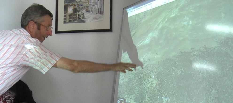
(Caption: Workshop participant providing information about the oak forest). Graphic materials were used as the primary support for delimiting this information. This included panoramic photo montages of the areas of interest, three-dimensional (3D) orthophotos on digital elevation models, and dynamic 3D views via Google Earth.
This video report shows highlights from the participatory mapping workshop.
Results
The main results included the geographic delimitation of several land uses and events affecting vegetation:
- Charcoal production (carboneo)
- Crops and farming
- Firewood harvesting
- Reforestation
- Wildfires
- Altitudinal migration of the oak forest (the rising of the "oak line")
Another key outcome was the mapping of Cáñar’s pagos, recovering some that date back to 1750. Using the Irrigation Community's maps as a base, we added the land divisions remembered by participants, noting their names and mapping their boundaries.
The results of this work can be consulted in the following map. Click on the different pagos to view the associated information.