Aims
The goal is to gather spatial information of the state of vegetation on Sierra Nevada in the past, broadening the time series as much as possible according to the existing historical archives.
Method and effort
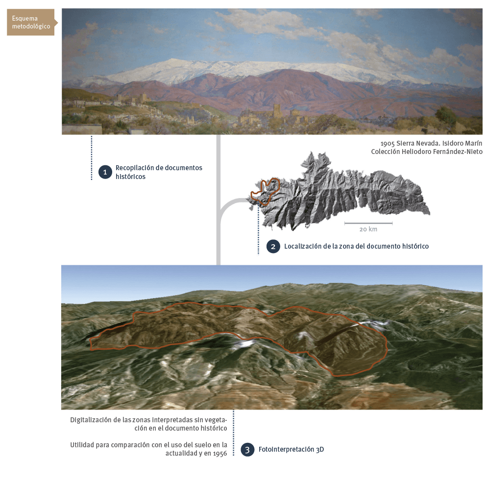
The working method consists of the search for and compilation of old documents of different characteristics and dates offering information on shifting land use and vegetation (e.g. descriptive maps, sketches, photographs, pictures, maps of forest-restoration projects, etc.). Afterwards, they are positioned and interpreted over the corresponding orthomap or orthophotos according to the date. The polygons of the interpreted plant formations are delineated and the attributes necessary for their characterization are assigned.
Periodicity
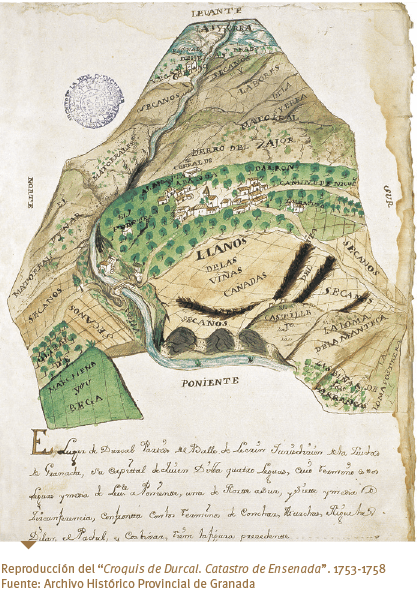
The periodicity of information gathering depends on the availability of sources that can be georeferenced. Some dates for which documents exist prior to 1956 are: 1753, 1763, 1805, 1932, and 1944.
References
Badia Miró, M. y Rodríguez Valle, F. 2005. Una nueva metodología para la reconstrucción de la evolución histórica del paisaje agrario. GeoFocus, 5: 69–78.
Fernández del Castillo, T., Delgado García, J., Cardenal Escarcena, F. J., Jiménez Peralvarez, J., Fernández Oliveras, P. y Irigaray Fernández, C. 2006. Generación de una base de datos de movimiento de ladera mediante técnicas de fotogrametría digital en la Sierra de la Contraviesa (Granada). Pp. 799-814 En: Actas del XII Congreso Nacional de Tecnologías de la Información Geográfica. El acceso a la información espacial y las nuevas tecnologías geográficas. Granada, Sep. 2006.
Gómez Ortiz, A., Milheiro Santos, B. y Serrano Giné, D. 2008. Nieves, hielos y aguas en los paisajes de Sierra Nevada. El interés de la información gráfica de los libros de época. Cuadernos de investigación geográfica, 34: 101–118.