Aims
The basic objective of this monitoring protocol is to assess the changes in incidence and abundance of the taxa as well as their role in the positive interactions between plants in maintaining biodiversity and ecosystem functioning in extreme environments and within a framework of global change. The methodology proposed pursues three specific aims: to advance in our knowledge of the structure and the functioning of these ecosystems over stress gradients; to evaluate the role of the positive interactions between vascular plants in this structure and functioning, and finally to apply the knowledge acquired to the management and conservation of the biodiversity in mountain habitats.
Method and effort
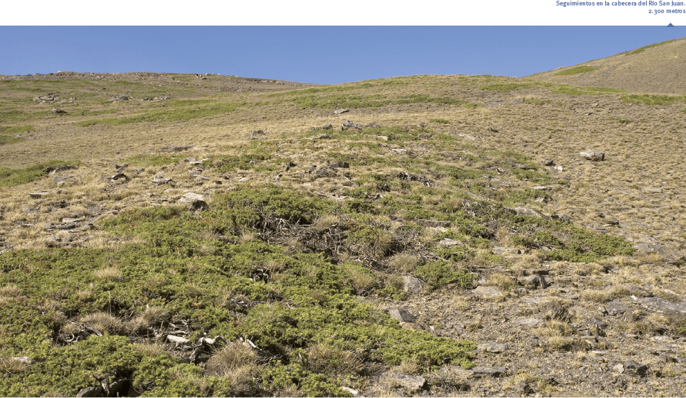
The monitoring is planned over an altitudinal gradient, combining two different situations or physiognomies that coexist at this elevation: the psicroxerophilous grasslands and juniper-broom shrublands to their altitudinal distribution limit. The structural difference is based on the different density of dominant shrubland species, particularly of brooms and junipers. All this is undertaken with three interrelated monitoring methods designed as: sampling by line intercepts, sampling of cover diversity, and the study of facilitation.
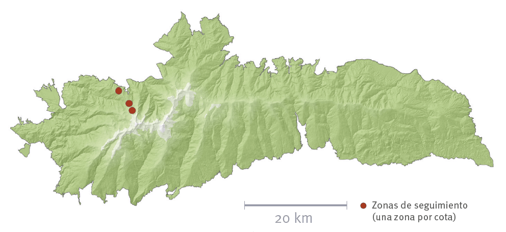
Con estas premisas se han instalado, desde los 2.300 a 2.700 m, parcelas pareadas con dimensiones de 30×30 m, con 2 o 3 réplicas por cota. Dichas parcelas pareadas se sitúan adyacentes y representan situaciones con distinta densidad de matorral, con un mínimo de 45 % para las del tipo “matorralizado” y 25 % para las más desprovistas de matorral. Cada una se subdivide en transectos cada 8 metros, sobre los se efectúan dos métodos de seguimiento. Por un lado, el de interceptación de línea que examina los distintos tipos de parcheado que de forma imbricada interceptan la línea marcada por la cinta métrica, así como sus dimensiones (ancho y puntos de corte con la cinta métrica) y las especies asociadas (entendiendo como “parche” los agregados de matorral o pastizal o bien de roca, u otros tipos de superficie). Por otra parte, para conocer en detalle la cobertura y diversidad, se registran mediante cuadrats de 1.5 m. de lado, la abundancia porcentual de los taxones presentes, así como de los distintos tipos de superficie (rocas o piedras fijas, piedra suelta, suelo desnudo, restos de materia vegetal o excrementos). Se consideran solo las especies perennes.
With the aim of determining the function of the ecosystem in relation to the nutrients and soil microorganisms, soil samples were extracted in the surroundings of the dominant species for each type of aggregate (Juniperus communis subsp. nana, Genista versicolor, Festuca indigesta) as well as bare soil.
The specific monitoring to study the phenomenon of facilitation included 20 isolated individuals of Juniperus communis and in turn Genista versicolor within a well-defined outline. This enabled comparisons of incidence and relative abundance of the species, according to the Braun-Blanquet scale, both for the specimen chosen as well as for the adjacent grassland.
Periodicity
Initially a triennial periodicity was established, to be modified depending on the results in successive replicates.
References
B.L.M. (Eds.) 1996. Sampling vegetation attributes. BLM Technical reference 1734-4. Bureau of Land Management´s National Applied Resource Sciences Center. Denver, USA.
Maestre, F. T., Callaway, R. M., Valladares, F. y Lortie, C. 2009. Refining the stress-gradient hypothesis for competition and facilitation in plant communities. J. Ecol., 97: 199-205.
Maestre, F. T. y Escudero, A. 2009. Is the patch-size distribution of vegetation a suitable indicator of desertification processes? Ecology, 90: 1729-1735.